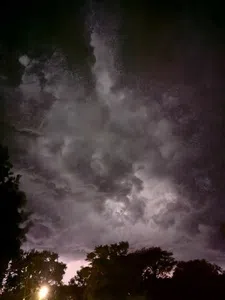
(Des Moines) The National Weather Service in Des Moines says a storm caused significant damage in north-central and east-central Iowa this (Wednesday) morning.
Christy Carter with the National Weather Service in Des Moines says the line of storms developed in northwest Iowa and moved in a southeasterly direction through north-central Iowa and into the east-central portion of the state, with reports of damaging wind gusts.
Carter says the Weather Service received reports of wind gusts as high as 94 miles per hour at the Marshalltown Airport. Ahead of that, Webster City reported 76 miles per hour wind gusts, and 78 miles per hour wind gusts at the Cedar Rapids Airport. Carter says they had several reports of wind damage around the Ames and Marshalltown areas.
Carter says we are in the typical summer months, with warm, moist air drifting northward from the Gulf, combining with cooler air coming out of the northwest to fuel these storms. Carter says we are looking at a few quieter days to end the week before more chances of rain return this weekend.
Carter says the Weather Service continues to assess the severe threat with this next system. She says the best chance for severe weather as of now appears to be on Saturday in Nebraska and Kansas. However, the weather service will have more details as we get closer to the weekend.