(Des Moines) The National Weather Service says severe weather could fire up in some areas of the state.
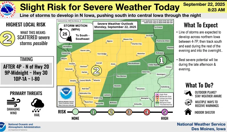
Forecasters say residents should remain vigilant today and tonight, as there is a Marginal Risk for severe weather across much of the state, with a slight risk extending to western and southwestern Iowa.
The National Weather Service has identified damaging winds and large hail as the primary threats associated with this evening’s storm activity. Local meteorologists are urging Iowa residents to stay informed about weather updates and take necessary precautions to ensure their safety. As the system moves through, thunderstorm activity is expected to persist in the forecast through at least Wednesday.
Meteorologists will be monitoring developments closely to assess any further severe weather threats that may arise in the coming days. Spotter activation may be necessary this evening, and officials are encouraging trained weather spotters to be ready to report any significant weather-related observations. Residents should prepare for changing weather conditions and follow any guidance from local authorities as Iowa navigates this period of heightened weather risk.