(Des Moines) The National Weather Service forecasts very strong northwest winds, gusting to near 50 miles per hour, from Tuesday night into Wednesday. On Tuesday night, rain will also change to snow from northwest to southeast.
Forecasters say falling snow combined with very strong winds will cause significant reduced visibility, with a period of blizzard conditions possible. Snow-covered roads will also make travel hazardous.
Weather forecasters say conditions should gradually improve later Wednesday as the snow ends and winds slowly subside.
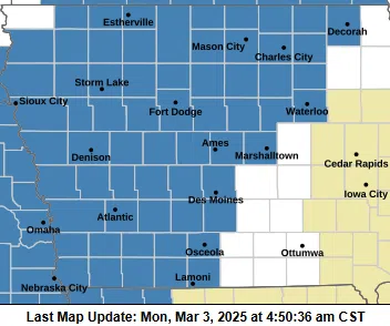
A Winter Storm Watch goes into effect for central and western Iowa from Tuesday evening through Wednesday afternoon. Blizzard conditions are possible, with light to moderate snow accumulations and gusts as high as 55 miles per hour.
Hazardous driving conditions could affect the Wednesday morning commute.