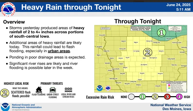
(Des Moines, Iowa) – Locally heavy rainfall drenched parts of the state on Monday, with widespread reports of 2 to 4 inches, and some areas seeing even higher totals. The National Weather Service says additional rounds of heavy rainfall over the coming days may increase the risk of flash flooding, particularly in already saturated areas.
Forecasters predict that river levels will continue to rise, and flooding in the river is becoming a growing concern by the end of the week.
More storms are forecasted through Thursday, with scattered thunderstorms expected each day. The most significant storm coverage is anticipated during the afternoon and evening hours.
While not everyone will see severe weather, isolated strong to severe storms are possible. Damaging wind gusts and heavy rainfall are the primary hazards. Meteorologists warn that storms will move slowly to the east-northeast, increasing the risk of localized flooding.
Residents are encouraged to monitor weather alerts, avoid flooded roadways, and prepare for rapidly changing conditions.