(Atlantic) A thunderstorm moved through Atlantic around 9:05 p.m., bringing strong, gusty winds that downed medium to large tree branches and blocked several roads. At times, pea-sized hail fell, and heavy rain resulted in zero visibility.
The National Weather Service recorded a wind gust of 60 miles per hour at approximately 7:51 p.m. one mile northwest of Coon Rapids. Severe thunderstorm warnings were issued for Harrison, Carroll, Mills, Audubon, Cass, Guthrie, and Fremont Counties, with the main threats being high winds and quarter-sized hail.
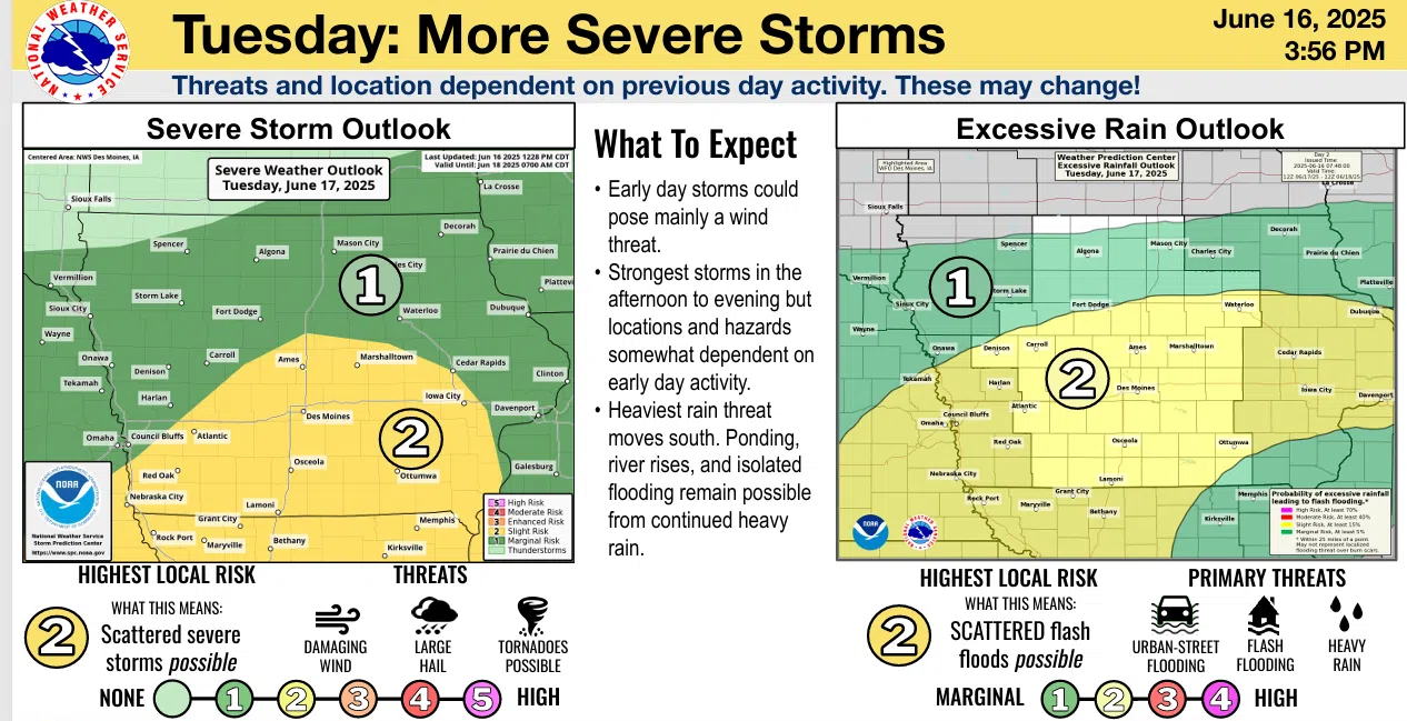
The National Weather Service forecasts the possibility of severe storms continuing through tonight, with damaging winds and hail as significant threats. Tornadoes are considered a secondary threat. Heavy rain is expected, which could lead to localized flash flooding. Although the chance for thunderstorms will persist into Wednesday, the risk of severe weather is low. Flooding and flash flooding will remain concerns until the storms pass and high-water areas recede.
Additional rounds of storms may occur from Thursday night into Friday, and again from Sunday night into early next week. More details on these later storms are expected to become clearer in the coming days. Hot and humid conditions are anticipated this weekend, particularly on Friday and Saturday, when heat indices are expected to exceed 100 degrees.