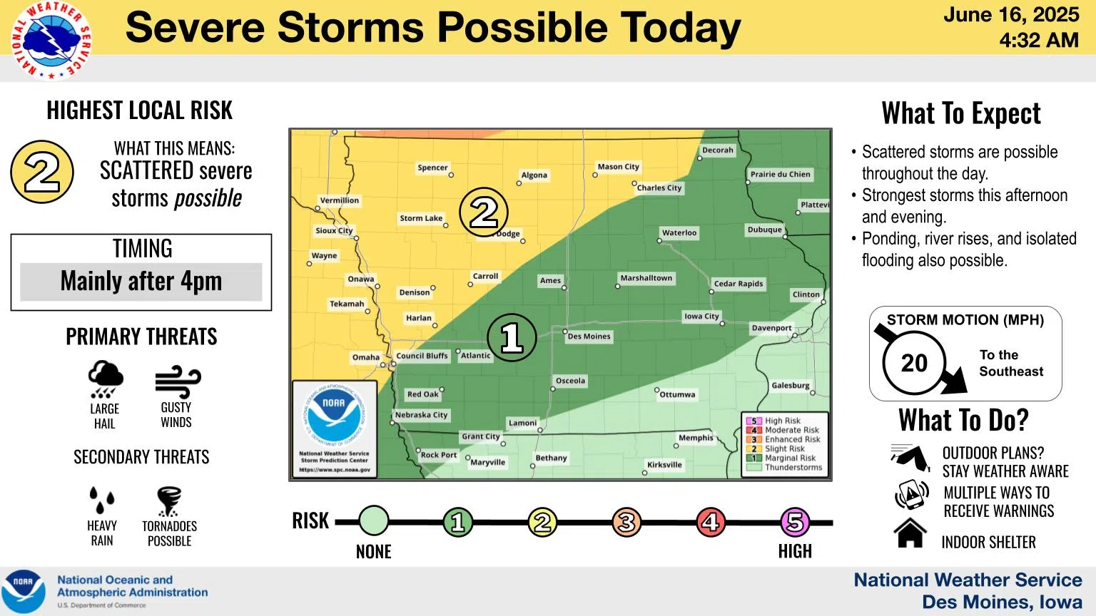
(Des Moines) The National Weather Service says active weather continues today with periods of storms once again expected.
The strongest storms are expected to occur in the afternoon and evening. A Slight Risk (Level 2 out of 5) for severe weather is expected over portions of northern and western Iowa, with a Marginal Risk (Level 1) for severe weather over much of central and southern Iowa. Large hail and gusty winds are the primary threats, though a few tornadoes are possible mainly north. Heavy rain again is expected with any storms, leading to the continued potential for ponding and river rises, along with isolated flooding.
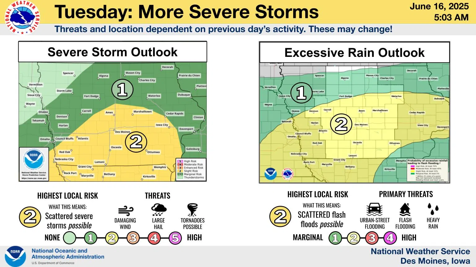
Another round of storms is expected on Tuesday. Some storms could be severe (level 2 out of 5 risk), with large hail, damaging wind, and a few tornadoes. Heavy rain is also a concern as it may lead to flash flooding and rising rivers. The location and timing of storms will depend largely on what happens with today’s storms.