(Des Moines) The National Weather Service says thunderstorms north of a line extending from the extreme southwest of Monona County to just north of Harlan, northern Audubon, and Guthrie counties, through Des Moines to the Quad Cities, could develop this afternoon.
Forecasters predict thunderstorms will develop between 4:00 p.m. and 10:00 p.m. this afternoon in the affected area of the state. The primary threats will be strong winds and hail.
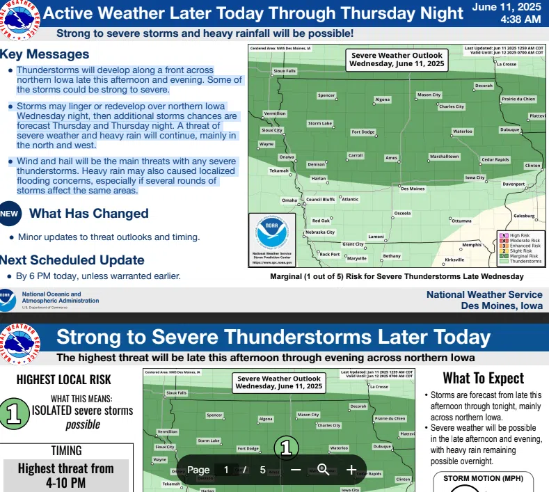
Thunderstorms will develop along a front across northern Iowa late this afternoon and evening. Some of the storms could be strong to severe. Storms may linger or redevelop over Iowa north tonight, then additional storm chances are forecast for Thursday and Thursday night. A threat of severe weather and heavy rain will continue, mainly in the north and west. Wind and hail will be the main threats with any severe thunderstorms. Heavy rain may also cause localized flooding concerns, primarily if several rounds of storms affect the same areas.