(Omaha/Valley) The National Weather Service has extended a Tornado Watch to include additional counties in southwest and west central Iowa. The area counties included in the watch until midnight include: Adair, Adams, Audubon, Carroll, Cass, Dallas, Fremont, Guthrie, Madison, Mills, Montgomery, Page, Taylor, and Union.
Thunderstorms are expected to develop early this afternoon along and east of I-29, though the greatest risk for severe storms will be between 3:00 pm and 8:00 pm. The severe storms will be capable of large hail, damaging winds, and isolated tornadoes are possible.
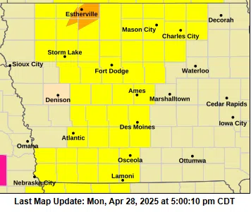
Meanwhile, the Des Moines office of the National Weather Service continues to forecast a moderate risk (Level 4 of 5) for severe weather across northern Iowa today. All types of severe weather are possible, including large hail, damaging winds, and tornadoes, some of which could be strong.
A conditional enhanced risk (Level 3 of 5) remains in effect for the rest of Iowa, with the most significant concerns still focused on northern areas.
The National Weather Service notes that many locations may not see storms today. However, where storms do develop, they could become extremely strong and dangerous.
The most intense activity is expected between 4 p.m. and midnight.
.