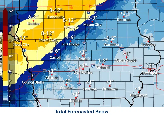
(Des Moines) Moderate to heavy snow and strong and gusty winds may produce blizzard conditions on Wednesday, according to the National Weather Service. Forecasters say two-inch-per-hour snowfall rates will be possible along with thundersnow. Damaging wind gusts of 60 miles per hour or more are possible, sometimes causing difficult to impossible travel conditions.
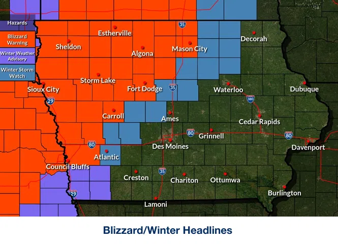
A Winter Storm Watch will go into effect from 7:00 a.m. to 10:00 p.m. Wednesday for portions of southwest, central, and northern Iowa. Blizzard conditions are possible, with between one to three inches of snow. Winds could gust as high as 65 miles per hour.
Strong winds and the weight of snow on tree limbs may down power lines and cause sporadic power outages. Whiteout conditions are possible and may make travel treacherous and potentially life-threatening. Travel could be challenging. Widespread blowing snow could significantly reduce visibility. The hazardous conditions could impact the Wednesday evening commute. Persons should delay all travel if possible.
Meanwhile, a Blizzard Warning goes into effect from 7:00 a.m. to 10:00 p.m. for portions of west central and northwest Iowa. This includes Pottawattamie, Shelby, Harrison, Monona, Crawford, and Carroll Counties.