(Area) Roadways in the southern two-thirds of Iowa are partially or mostly covered with snow this morning.
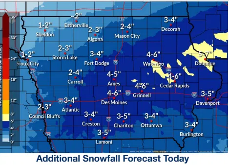
According to the National Weather Service, snow will continue over much of southern and central Iowa early this morning through the day today while also expanding northward toward the Minnesota border. Snow intensity should peak between 5 a.m. and 9 a.m. but also continue at lesser rates throughout the day. The highest snow accumulations will be along and south of US Highway 20 over portions of central and southern Iowa, with 5 to 8 inches expected.
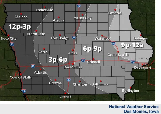
The Iowa Department of Transportation is reporting snow-covered and slick roads over southern and central Iowa, creating hazardous travel. Visibility will be reduced in falling and minor blowing snow, creating minor to moderate impacts. The snow will taper off from west to east late this afternoon into this evening, though flurries may persist for several hours after the main snow accumulation ends.
A Cold Weather Advisory goes into effect for western and northern Iowa from midnight tonight until 9:00 a.m. on Thursday. Wind chills are expected to drop to 20- to-25 below zero.