(Omaha) The National Weather Service in Omaha says the tornado that struck Minden is rated an EF-3.
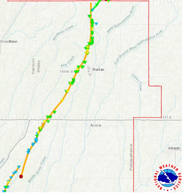
This tornado formed east of McClelland, while the previous Treynor/McClelland tornado was in the process of dissipating (info on that tornado below). The tornado tracked north-northeast through the eastern part of Minden to the immediate east of Tennant, then west of Harlan and the immediate east of Defiance before dissipating just south of the Shelby/Crawford County line. The tornado began at 5:25 p.m. and ended at 6:29 p.m., tracking 40.9 miles. The estimated peak winds were 160 mph. The max width of the tornado was 1700 yards.
A tornado that developed in rural southwestern Pottawattamie County southwest of Treynor and tracked north-northeast before dissipating to the northeast of McClelland is rated an EF-3. The tornado began at 5:08 p.m. and ended at 5:28 p.m., tracking 13.3 miles. The estimated peak winds were 145 mph. The max width was 800 yards.
The tornado that developed near Omaha’s Eppley Airfield and moved northeast to just east of Crescent before dissipating just north of the Harrison-Pottawattamie County line was rated an EF-3. The tornado began at 4:58 p.m. and ended at 5:27 p.m., traveling 16.1 miles. Estimated peak winds were 152 mph. The max width of the tornado was 516 yards.
A tornado that developed over the V&W Petersen Wildlife Management Area near the Shelby/Crawford County line and moved north to the immediate west of Manilla was rated an EF-2. The tornado began at 6:28 p.m. and ended at 6:44 p.m., traveling 9.2 miles. The estimated peak winds were 112 mph. The max width was 200 yards.
A tornado that developed to the southeast of the I-29/U.S. 275 interchange in Mills County and tracked north-northeast before dissipating at the Pony Creek Park is rated an EF-1. The tornado began at 4:52 p.m. and ended at 4:57 p.m., traveling 2.7 miles. The estimated peak winds were 100 mph. The max width was 80 yards.
A tornado that developed to the immediate northeast of Defiance and tracked north-northeast into rural Crawford County east-southeast of Denison was rated an EF-1. The tornado began at 6:51 p.m. and ended at 7:08 p.m., traveling 12.3 miles. The estimated peak winds were 107 mph. The max width was 100 yards.


