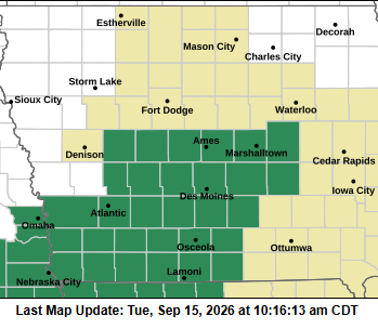
(Area) A Flash Flood Watch remains in effect for the area through midday Wednesday.
A slight risk of excessive rainfall is in place today as a cold front moves through the region. Flash flooding is possible, especially in areas that receive multiple rounds of thunderstorms and heavy rain.
Additional rounds of thunderstorms and heavy rainfall are expected at times through much of the week. The threat for flash flooding and river flooding will increase with each round of heavy rainfall.
Residents are encouraged to monitor weather conditions and be alert for possible flood warnings.
Weather information and updates are available at weather.gov/dmx.
Spotters are encouraged to safely report instances of flash flooding.