(Omaha/Valley, Nebraska) The National Weather Service released more information on Thursday’s storms.
According to the report, two powerful, long-lived supercells tracked across eastern Nebraska and southwest Iowa during the afternoon and evening hours of April 17. The storms produced widespread damaging hail up to 4 inches in diameter, wind gusts greater than 80 mph, and multiple tornadoes.
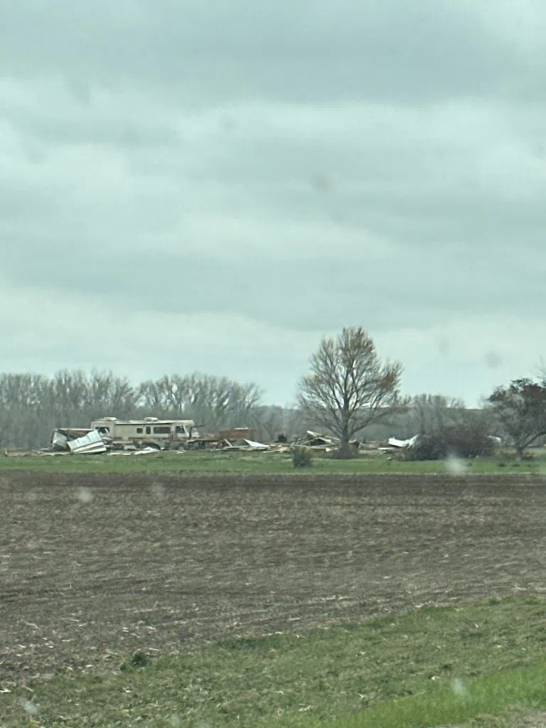
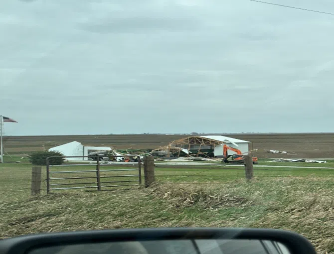
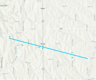 Approximately 8:13 pm on Thursday, April 17, 2025, a tornado formed 3 miles southwest of Tabor. The tornado stirred up copious dust and dirt from a recently plowed agricultural field. The tornado moved southeast across mainly agricultural fields until crossing U.S. 275, producing EF-0 damage to roofs and farm outbuildings just south of 130th Street, reaching a width of about 1/4 mile. Based on the video, the tornado weakened briefly east of U.S. 275 until it crossed 280th Avenue, reaching a width of about 1/4 mile and strengthening again before crossing 290th Avenue, producing EF-0 damage to trees and flipping irrigation pivots. The tornado continued until about 300th Avenue and 140th Street intersection, where it dissipated.
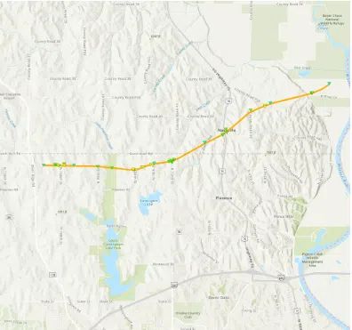
At approximately 8:32 PM CDT, a tornado formed southeast of Randolph, IA. The first sign of damage was snapped tree limbs near Lake Shawtee WMA. As the tornado progressed eastward, continued tree damage was observed along with damage of small outdoor
farm buildings and house roofs.
A concentrated area of the most extensive damage was observed south of Imogene, IA. In this area, damage included snapped wooden power poles, minor damage to homes, and continued damage to outdoor buildings and trees. The width of damage also reached its peak, approximately 3130.6 yards.
The tornado tracked just north of Essex, IA, with more wooden power poles snapped and farm outdoor building damage. After sliding north of Essex, IA, the tornado tracked northeast towards Nyman, IA. Similar damage, including trees, outdoor buildings, and wooden power poles, was observed along this stretch. The tornado lifted just east of Nyman, IA, at approximately 9:08 PM CDT.
(Photos: Courtesy of the National Weather Service website)