


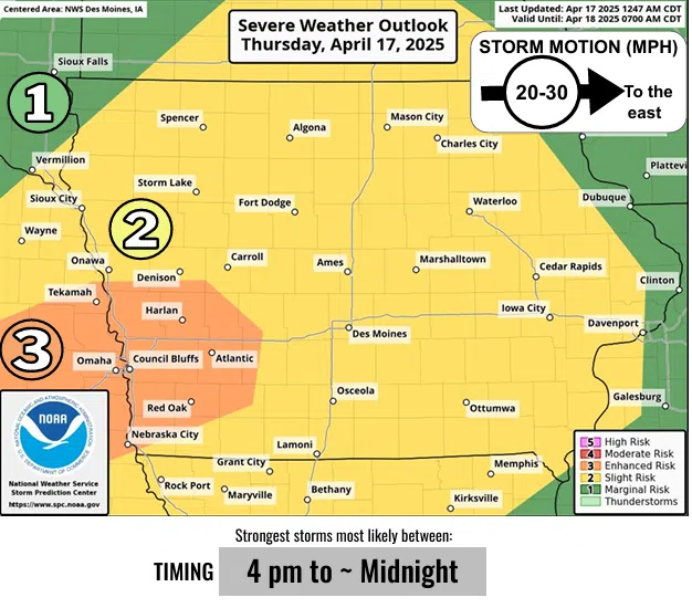
(Des Moines) The National Weather Service in Des Moines reports that the risk of severe storms in the state’s southwest region is enhanced, and the risk is slight elsewhere.
“Southwest Iowa is under the highest risk of severe weather later this afternoon and evening,” said Alexis Jimenez, with the National Weather Service in Des Moines. “The main threat will be large hail, but damaging winds and a few tornadoes are possible.”
“We will start to see storms form over Lincoln, Nebraska, into the Omaha area around 3:00 p.m., cross into southwest Iowa around 4:00 p.m., and move into central Iowa later in the evening, “stated Jimenez. “We cannot rule out gusty winds and a possible tornado. The biggest threat is significant-sized hail.”
Adams, Audubon, Cass, Mills, Montgomery, northern Fremont, Pottawattamie, and Shelby Counties are at an enhanced risk from severe weather.
Keep tuned to KSOM or KS95 for the latest severe weather coverage.


