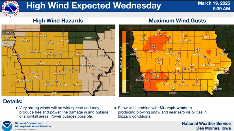
(Des Moines) Moderate to heavy snow and strong, gusty winds will produce blizzard conditions today.
Rod Donavon, Meteorologist with the National Weather Service in Des Moines, tells KSOM/KS95 News to expect a wide variety of weather across the area today. He says rain will change to snow with a heavy band of the white stuff across portions of west central extending to north central Iowa. “We are looking at the Denison, Carroll area, possibly down towards Audubon, and northeast towards Mason City,” said Donavon. “There could be a band of snow 8’-to12’ inches of snowfall in that region.”
Donavon expects a tight snowfall gradient as the system moves across Cass, Audubon, and southern counties, where snow amounts will taper off significantly. Winds will increase throughout the day, with gusts from 55 to 65 miles per hour.“You can imagine even a little bit of snow will cause blizzard conditions, and roads will become impassable,” stated Donavon. “Even areas with one to two inches of snow will have significant travel impacts.”
Donavon says the heaviest snowfall will occur this morning at 1′ to 2 inches per hour in Carroll, Denison, and northern Audubon County.
A Blizzard Warning is in effect until 10:00 p.m. this evening for Pottawattamie, Harrison, Shelby, Audubon, Crawford, Carroll Counties, and areas to the north.
A High Wind Warning is in effect for the rest of southwest Iowa until 7:00 p.m. A Winter Storm Watch is in effect for this region until 10:00 p.m.
Temperatures will warm into the upper forties on Thursday, 50s on Friday, and 60 degrees on Saturday.
The complete interview with Rod Donavon is posted below: