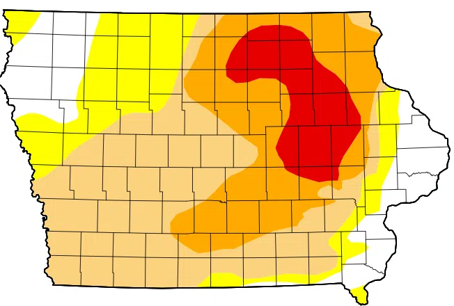
(Des Moines) The latest U.S. Drought Monitor map released on Thursday showed improved drought conditions in portions of Iowa. Climatologist Justin Glisan says drought was removed from the far eastern counties, reflecting the seven-day reporting period of precipitation totals approaching 200 to 300 percent of normal. He says some areas received one, two, and three inches of rainfall.
Southwest Iowa received 40 percent of its average rainfall for this reporting period, causing a moderate drought.
Glisan says that each week, we would need to hit about one half to seven-tenths of an inch to maintain the status quo and avoid degradation.
Meanwhile, the U.S. remains in an El Nino advisory, and a La Nina watch, with a high probability iin transitioning to an enso nuetral, and shoft to a La Nina this summer.
Glisan says the Storm Prediction Centers four-to-eight day outlook calls for a slight risk of severe weather for southwest Iowa, and shifting into eastern Iowa. Keep it tuned to KSOM/KS95 for the latest severe weather updates.


